
Icons: ![]() Layer
Layer ![]() Scale
Scale ![]() Beginning of the tour
Beginning of the tour
Tour Start in the Bruno Taut Shop
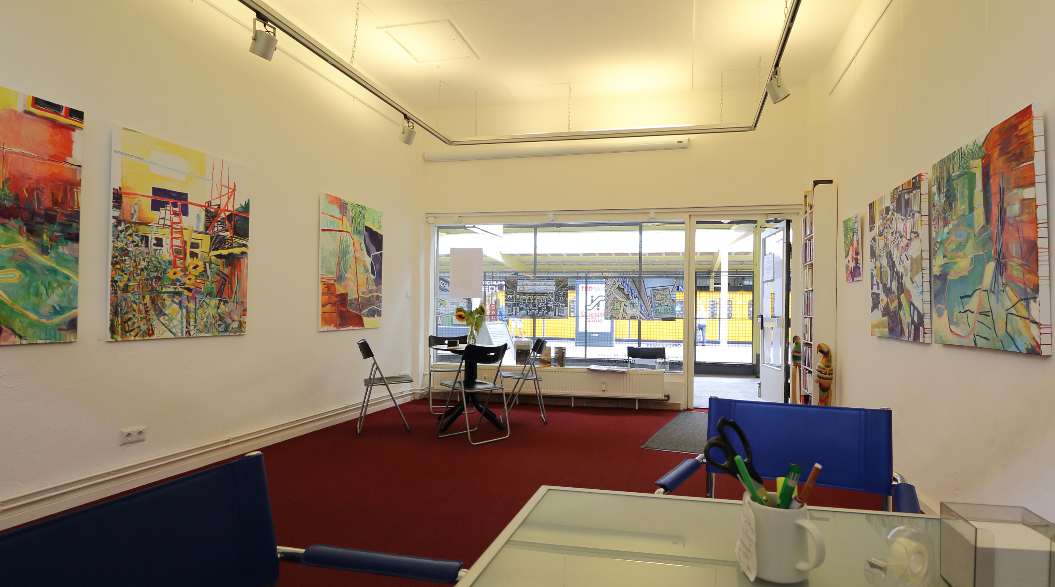
The tour starts at an originally sized 44-square-meter retail unit of the subway’s shopping promenade. Here you will find the Bruno Taut Gallery and archive. Guides usually meet up with tour participants in front of the large site map of the settlement where they begin their introduction about the settlement’s history and development. A room at the back exhibits objects from the life and work of Bruno Taut and contains copies of archival material in binders. This space also offers room for small discussion groups. Back to map
01 In front of the Bruno Taut Shop

In 1929 the subway line was extended from Thielplatz to Krumme Lanke. Onkel Toms Hütte station was built here according to plans by the Swedish architect Alfred Grenander. This was followed two years later by the construction of the shopping promenade (parallel to both sides of the tracks), which opened in 1931 with about 30 individual shops as well as a cinema to serve as a cultural venue. Initiators were the investor Adolf Sommerfeld and the architect Otto Rudolf Salvisberg. Since the emergence of the ‘shopping street’ (promenade) with small retail stores, the business structure has changed in favor of larger business units and anonymous management. For a short time, the Uncle Tom Kino (cinema) was also the lecture hall of the Freie Universität (Free University) after its departure from Unter den Linden. These premises were converted into a supermarket after 1968. After the war and during the occupation of Zehlendorf by the Americans, the shopping promenade was closed off to Germans and used exclusively by members of the US military. Germans were provided with barracks for shopping along the Argentinische Allee. Back to map
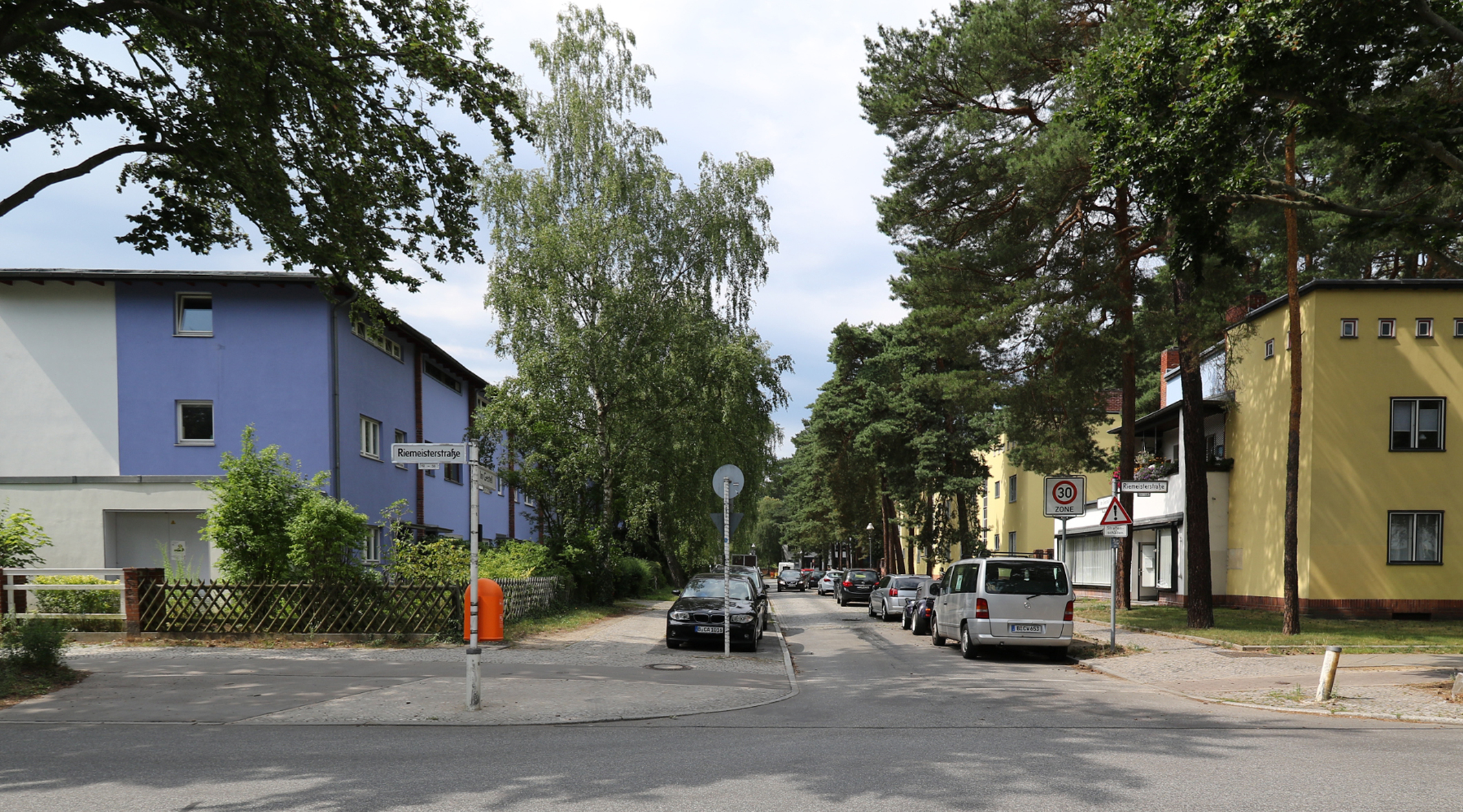
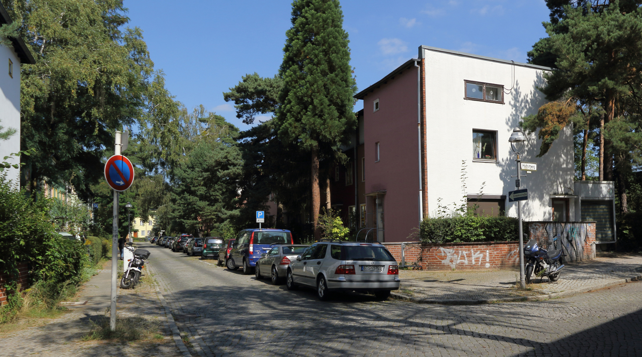
02 Station Forecourt Riemeisterstrasse/Subway Entrance
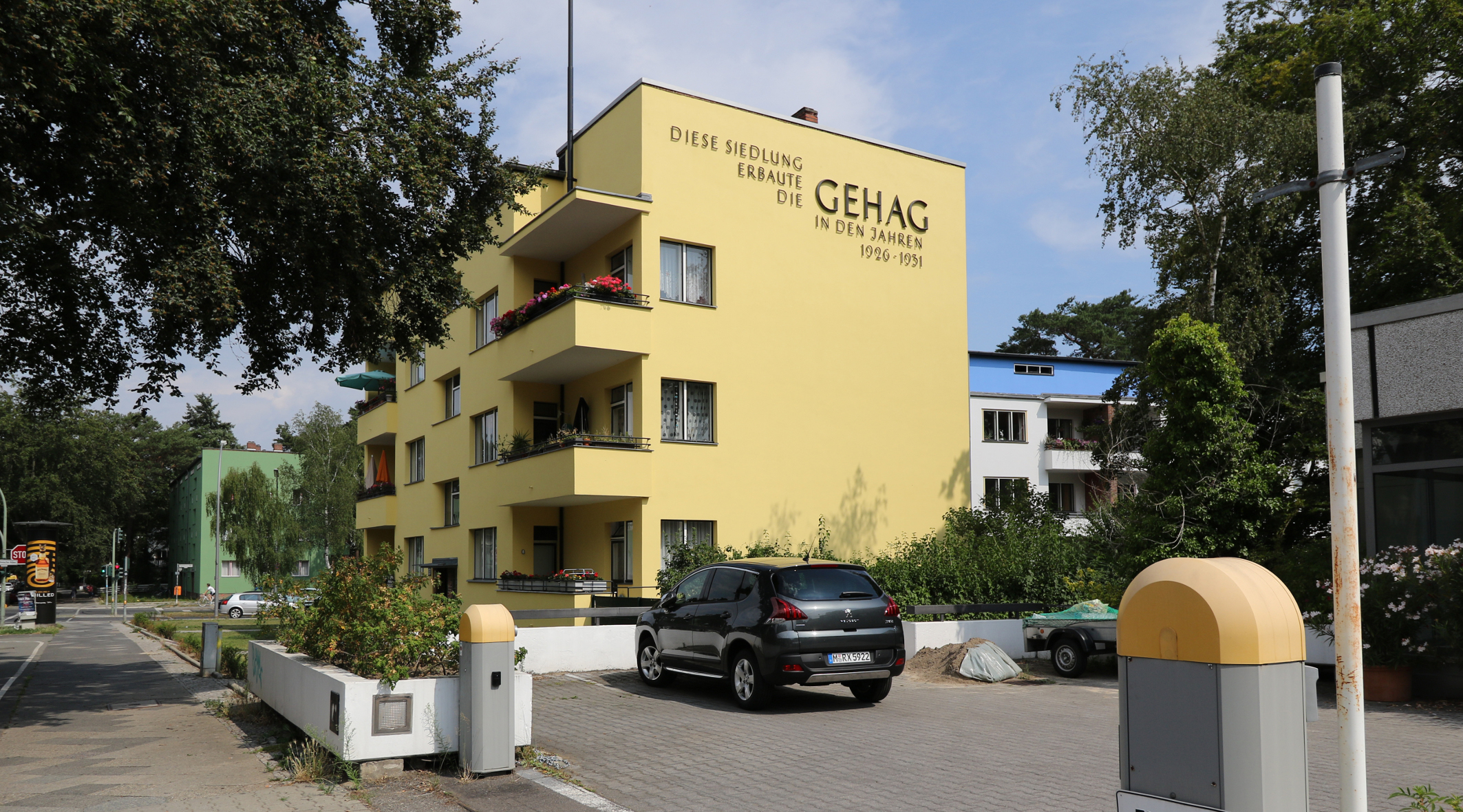
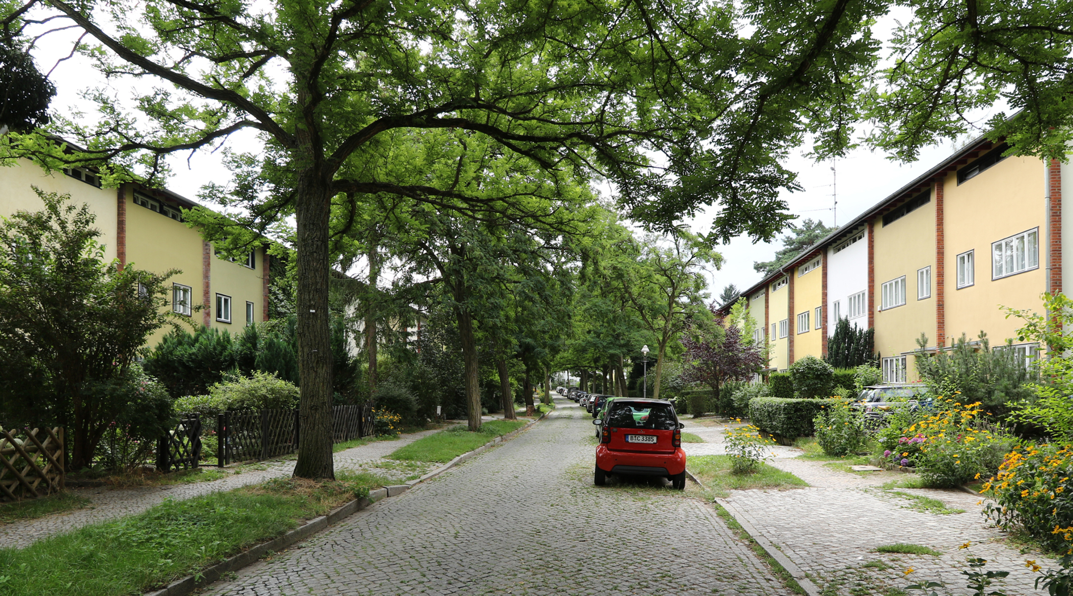
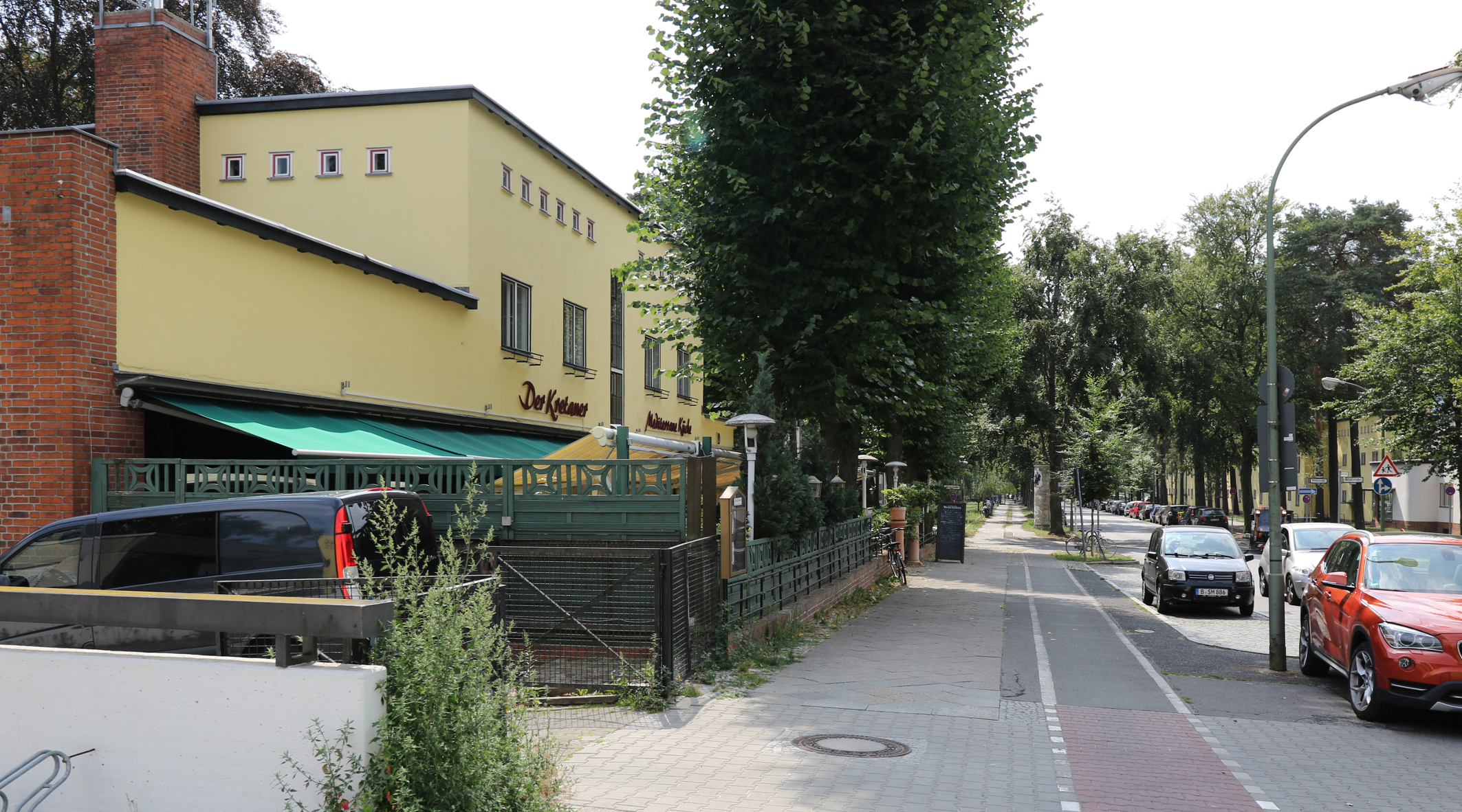
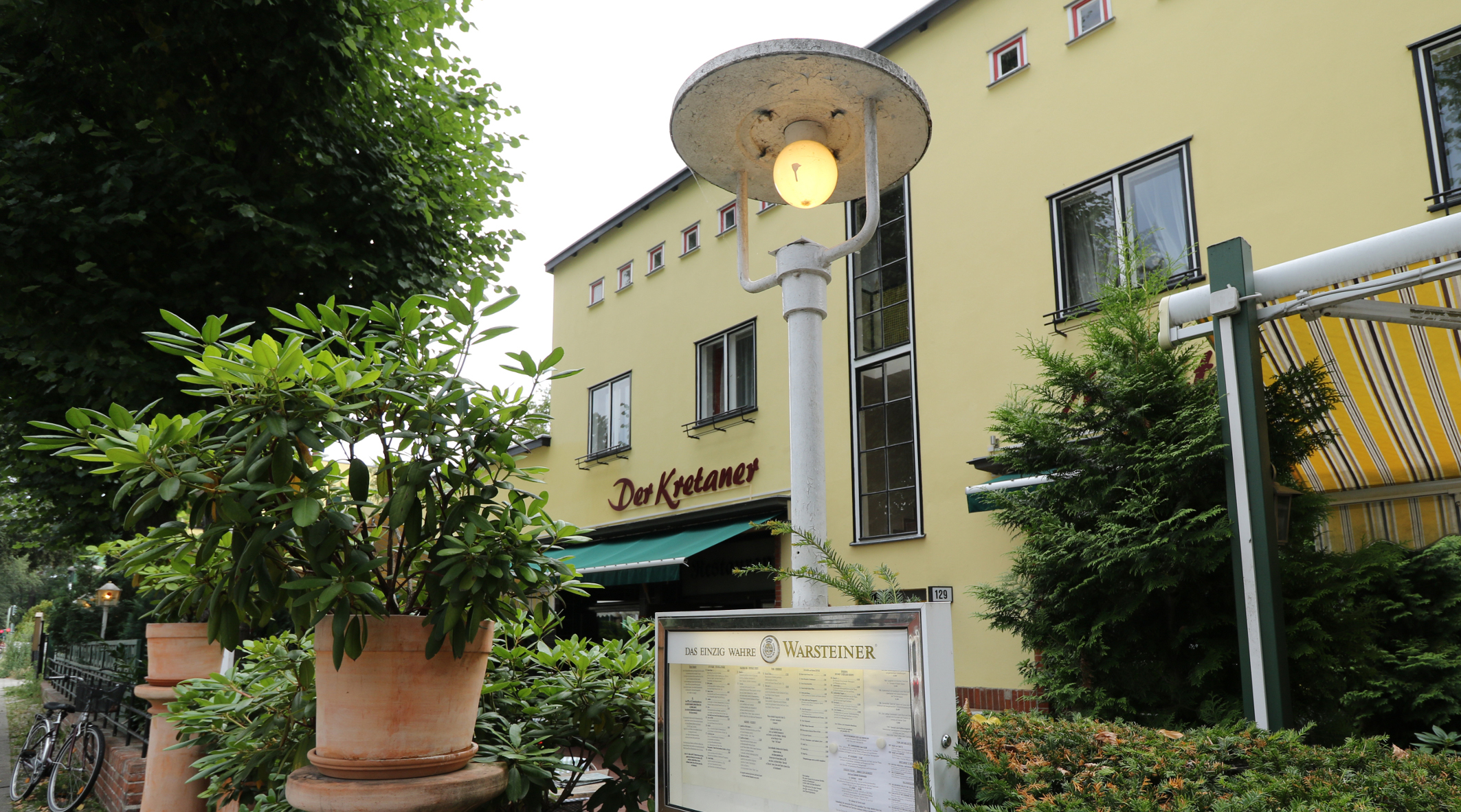
After leaving the BRUNO TAUT SHOP the route begins in the forecourt of the underground station at Riemeisterstrasse (on the opposite side of the street). Here you can enjoy a panoramic view of the attractively designed 2-storied station façade with its brick columns, and clinker-decorated entrance. It stands between the 5-storied, white stucco apartment buildings that rise to either side of it. Red balconies complement the bricks that were used to build the station. An inscription on the yellow south end wall of the 3-storied apartment building at Riemeisterstrasse 131 reads “This housing estate was built by GEHAG between 1926-1931”. A few meters further south is a restaurant with a garden terrace built according to the plans of Bruno Taut. Today it operates under the name “KRETANER”. One of several important social venues, it continues the long tradition of eating establishments that began shortly after settlement completion. The restaurant is combined with a small hotel. In a sense, it replaced a community center that was planned (but never built) by the architect Fred Forbat during the short period of settlement construction. The view further to the south gives way to two ground-level pavilion buildings located on both sides of Riemeisterstrasse adjoining the main buildings of the Wilskistrasse apartment ensemble. The eastern pavilion, on which the “Friseurkunst” sign remains, once housed a hair salon (since 2015 an architectural office); the western one has served a succession of purposes including drugstore and flower shop. A private day care center is housed there now. Like these pavilions, there were other decentralized facilities for housing-related services throughout the settlement. Today similar facilities – mostly day-care centers and dental practices – can be found. Back to map
03 Riemeisterstrasse
corner of Wilskistrasse
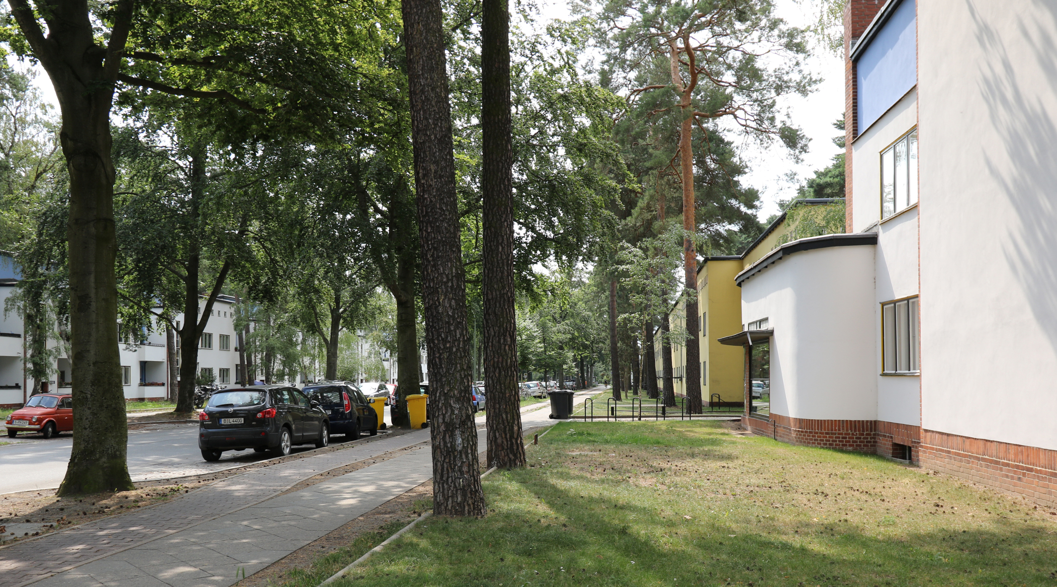
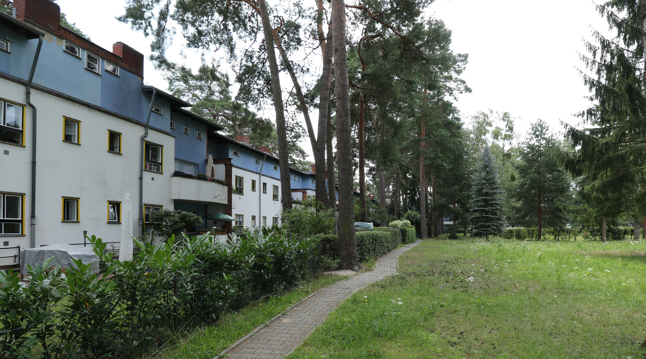
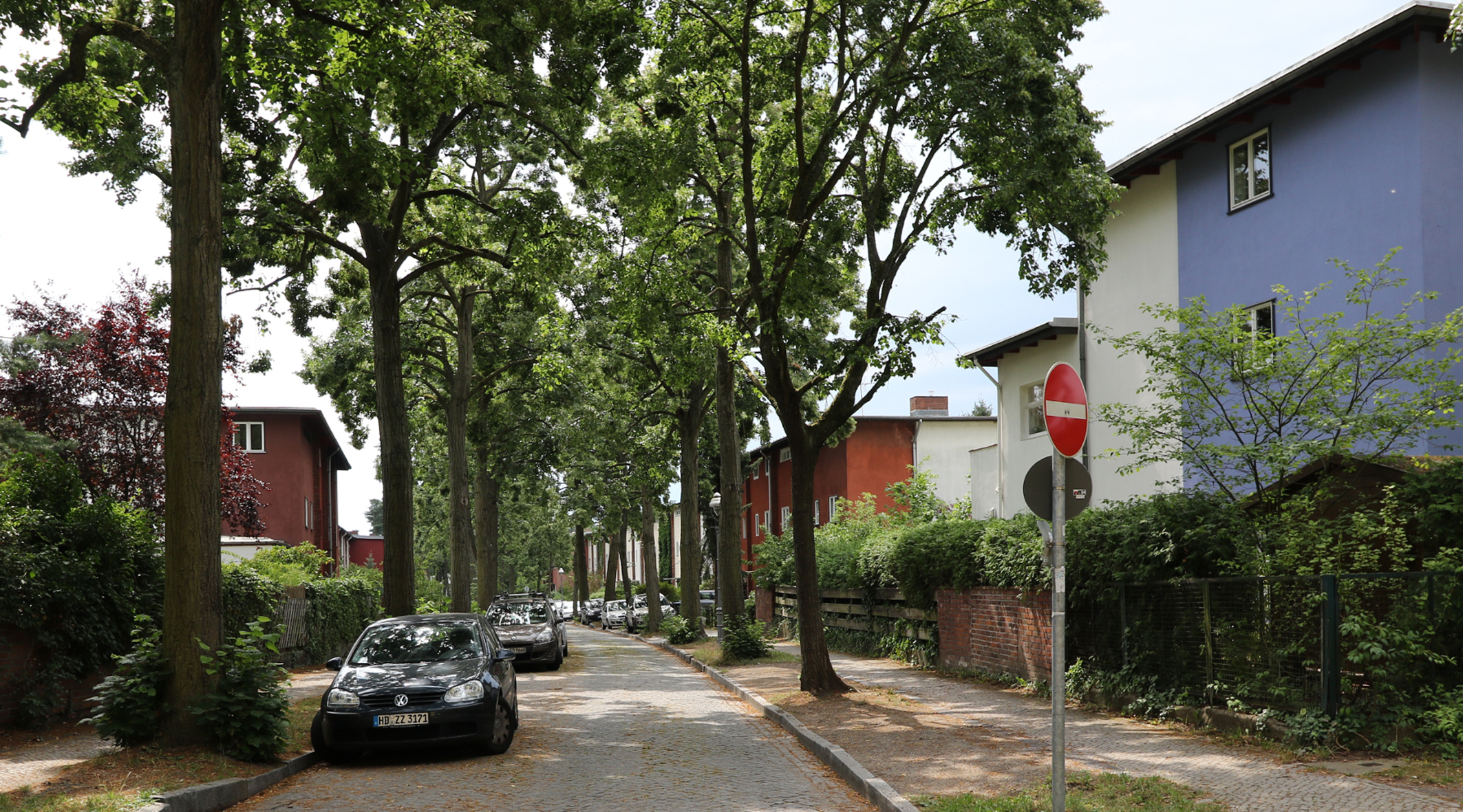
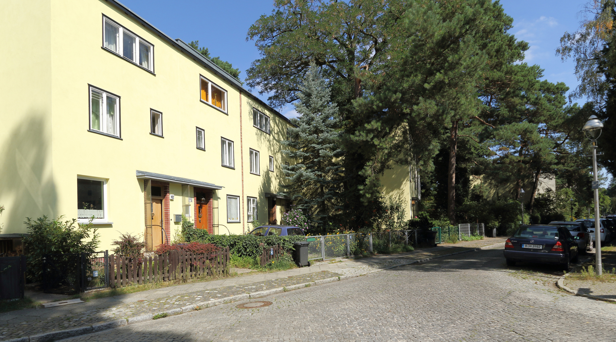
Here at the corner of Wilkistrasse, the halfway point of Riemeisterstrasse, we look south between its gateway-like corner buildings. It boasts an impressive width along its entire length. Large beech trees along the road and pine trees near the houses give it an avenue-like character. Front gardens on both sides round out the picture at the southern end of Riemeisterstrasse. On the left – eastern – side, is the living room side with balconies; the front garden areas run approx. 7.5 meters deep. On the right – western – side, you’ll find the bedroom side with gardens that are approx. 5 meters deep. The total width of Riemeisterstrasse is 15 meters. This street runs through the entire settlement in a north-south direction over a length of approx. one kilometer. Back to map
04 Kiefernhof (Pine Courtyard)
Construction Phase I (BA I): Pine Courtyard and surroundings
Construction Phase I borders directly on to the block of buildings along the south side of the underground station with its shopping promenade. Its boundaries are formed by Wilskistrasse to the north, Waldhüterpfad to the west, Riemeisterstrasse to the east and Im Gestell to the south.
This section also includes the neighboring roads – rental housing developments to the west on Waldhüterpfad, on the east of Riemeisterstrasse and to the south as far as the north side of Im Gestell, as well as the terraced house development along Eisvogelweg.
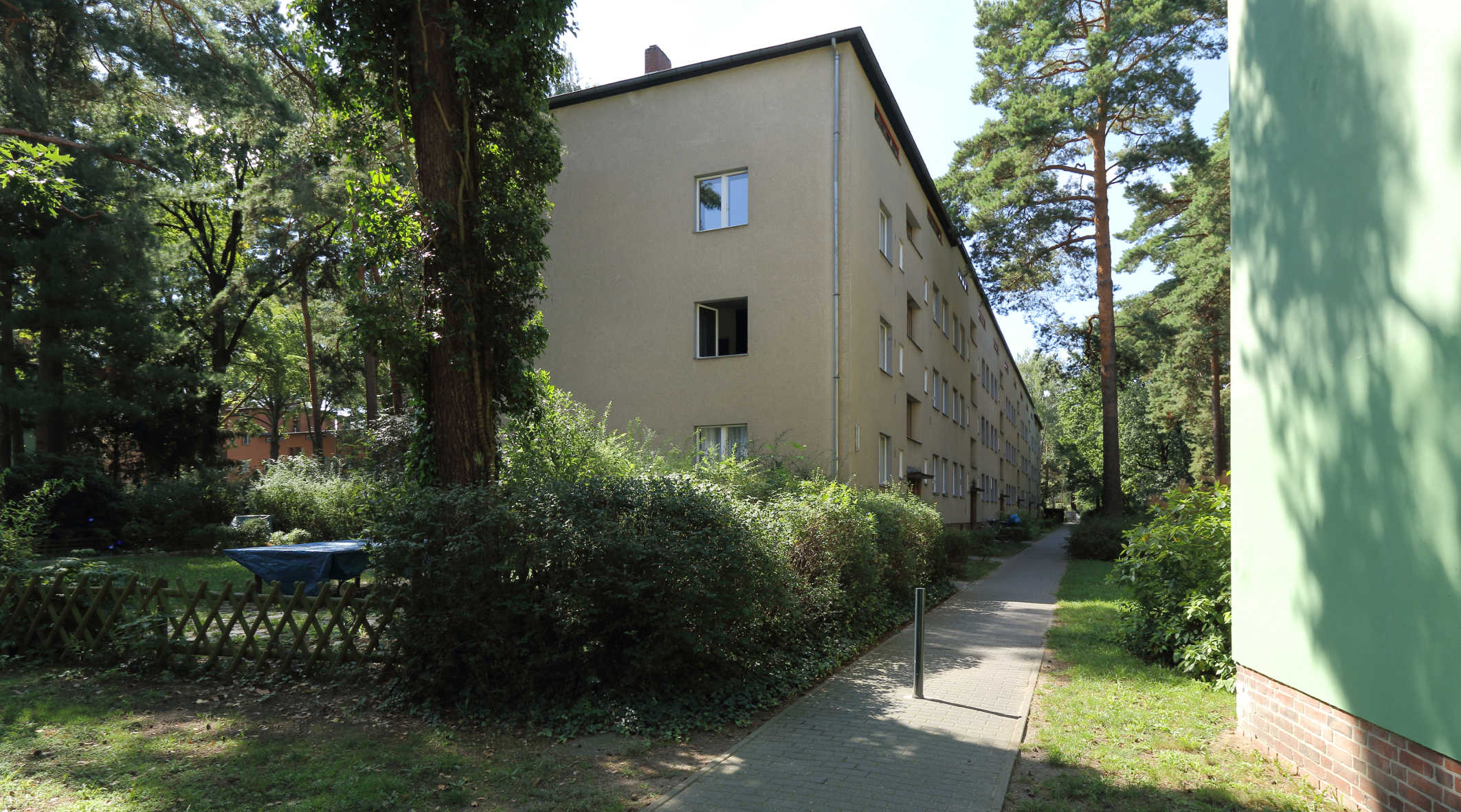
This apartment house type is typical for this first construction phase. It was subsequently applied to other areas along Riemeisterstrasse – from Wilskistrasse to Im Gestell – and along throughout Wilskistrasse. The apartment type consists of 2½ rooms and 65 m² of living space. Apartments are combined in pairs, one pair per story, and four apartments per house. These individual elements are organized into formidable groups with entryways.
Route: One reaches the interior of Kiefernhof from southwestern Riemeisterstrasse through a gate in the fence. We enter the Kiefernhof at the day care center pavilion on the right-hand side of the corner of Wilskistrasse and Riemeisterstrasse. It is only accessible as part of a guided tour since the gate is usually locked.
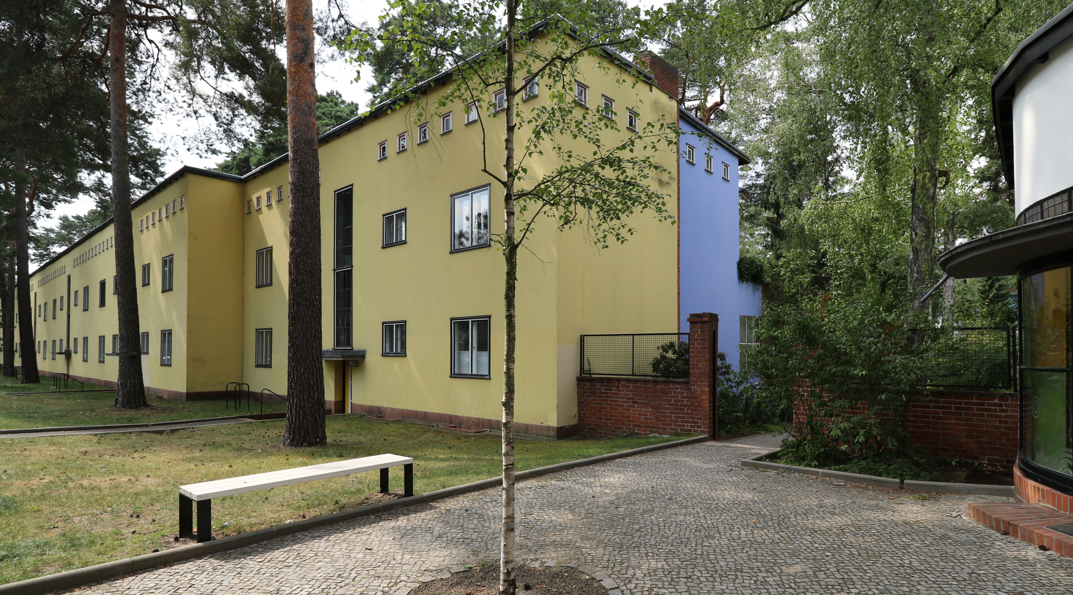
Look: The Kiefernhof development is formed almost exclusively of 2-story apartment buildings with an attic that is used as drying room.
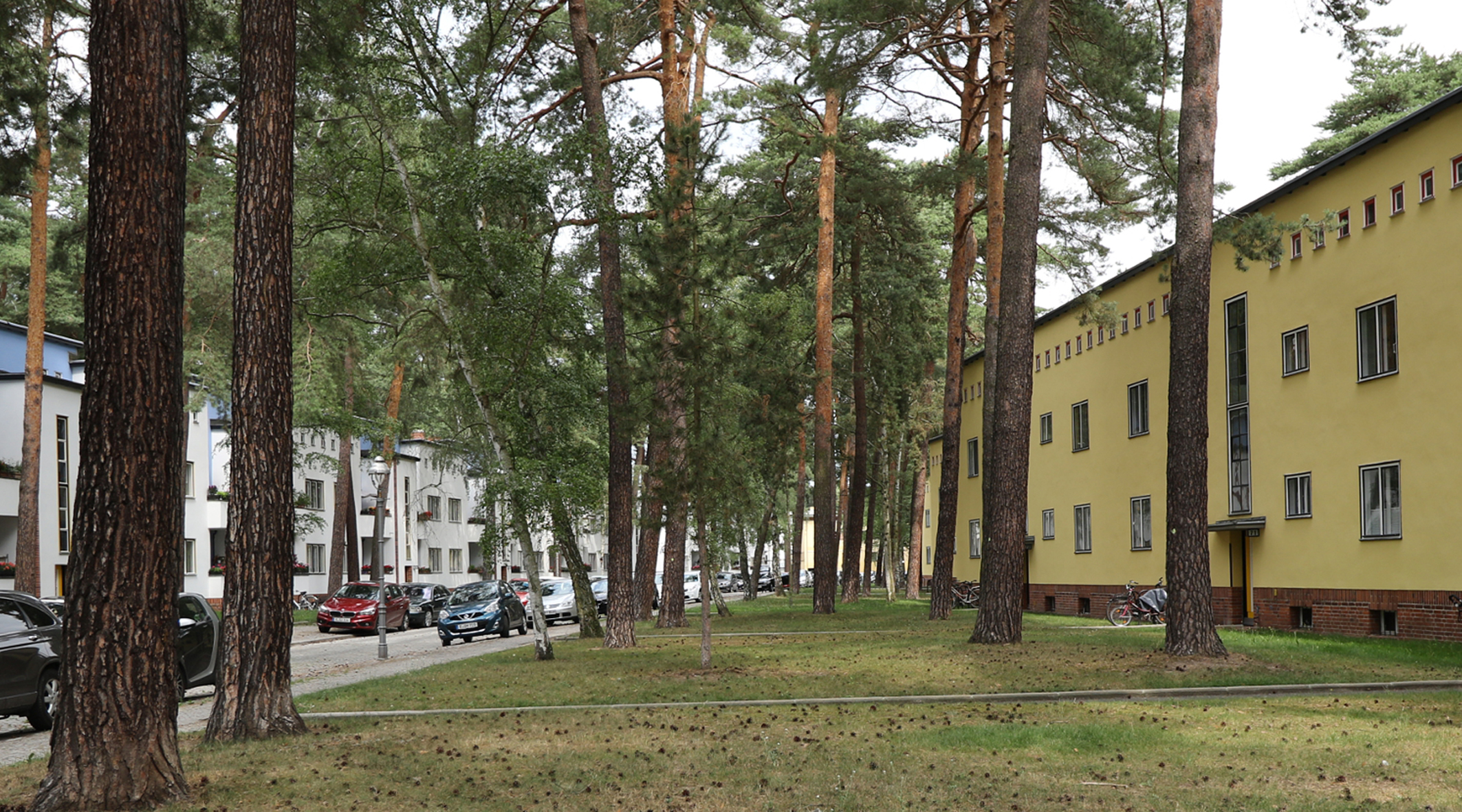
Kiefernhof was created by the surrounding streets already mentioned. Along Wilskistrasse, Riemeisterstasse and Im Gestell there are building sections standing at right angles to one another. The western sections, by contrast, have staggered stories; each story of three is set back incrementally, standing at a slight angle to the otherwise rectangular courtyard. Kiefernhof is planted with pines and birches. In the middle there is a playground for toddlers and seating for the elderly. In front of the staggered houses on Waldhüterpfad is one of the few larger green areas in the settlement.
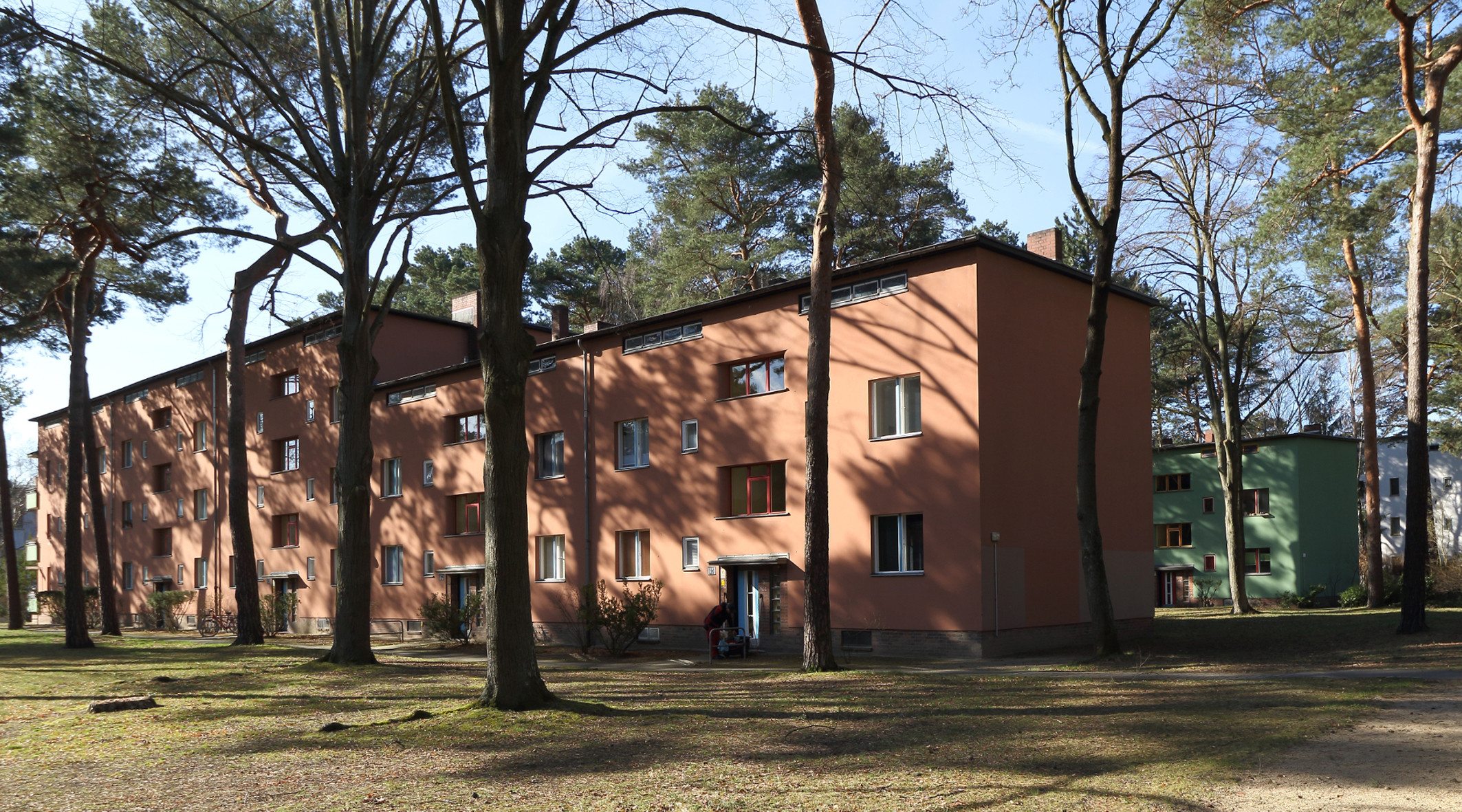
Background Info 1:: On average, the block has a length of approx. 81 m in an east-west direction and a length of 121 m in a north-south direction. It is the largest block of the entire settlement. The block sides are formed alternatively by living-room-and-kitchen-with-a-balcony units or by bedroom-and-bathrooms units. The block is made up by bedrooms and bathrooms on the north side and living rooms, balconies and kitchens on the east, south and west sides. Thus it is achieved that the main living spaces on 3 sides face to the large quiet, green and open space – independent of the optimal sun exposure situation.
Each building consists of the four apartments that share one garden. An opening in the loggia railing provides direct access for residents of the ground floor apartments. The first floor apartments reach the garden via a cellar corridor and a garden staircase.
Architecture: The architectural design of the three courtyard sides, west, north and east, is differentiated by altering forms and is characterized by variating bold colors that look as though they were different materials. The chimney heads protrude decoratively from the roof line. The exterior blue and white plaster material is accentuated by red clinker bricks in the plinth, the loggias and the roof finishes. The loggias’ edges are turned by 45 degrees and reinforce the Expressionistic optic. Early Dutch as well as Expressionist influences on Bruno Taut are very noticeable here. In the course of time – through to construction phase VII in 1932 – these influences decrease.
Background Info 2:The Kiefernhof was the first block of apartments in the settlement. It was built as early as 1926-27. There were considerable disputes concerning its building permit between GEHAG, as the building owner, and the district of Zehlendorf, as the approval authority. The chief construction manager of GEHAG, Martin Wagner, and Bruno Taut received threats of both fines and imprisonment. Intervention by the State of Berlin (chairman of the Berlin magistrate, Lord Mayor Gustav Böß) was necessary to secure a building permit. As mentioned in the introduction, Zehlendorf politicians had tried to exclude lower income groups in “bourgeois Zehlendorf”.
Background Info 3: The famous annual Fischtalfest (Fischtal festival) ended its procession at the Kiefernhof, which was transformed into fairgrounds for the occasion during the early years of the housing settlement. Children and adolescents paraded with a wagon in the form of a several meters long catfish through the settlement on the way to Kiefernhof, which was a community green area at the time. There were stalls, merry-go-rounds, dance floors and the like: Big and small, young and old celebrated until late into the night. This cheerful celebration was banned when the Nazis seized power in 1933. They replaced it with paramilitary marches and fighting games by the Hitler Youth in Fischtalpark. After the war there was no revival of these festive activities in Kiefernhof, though annual festivals are held today throughout the entire district.
Route:After the walk through Kiefernhof – along the east side of the building complex – exit at Im Gestell. This will take you to the second construction phase.
Back to map
05 Construction Phase II (BA II)
Exit Pine Courtyard – at Im Gestell – Begin Construction Phase II
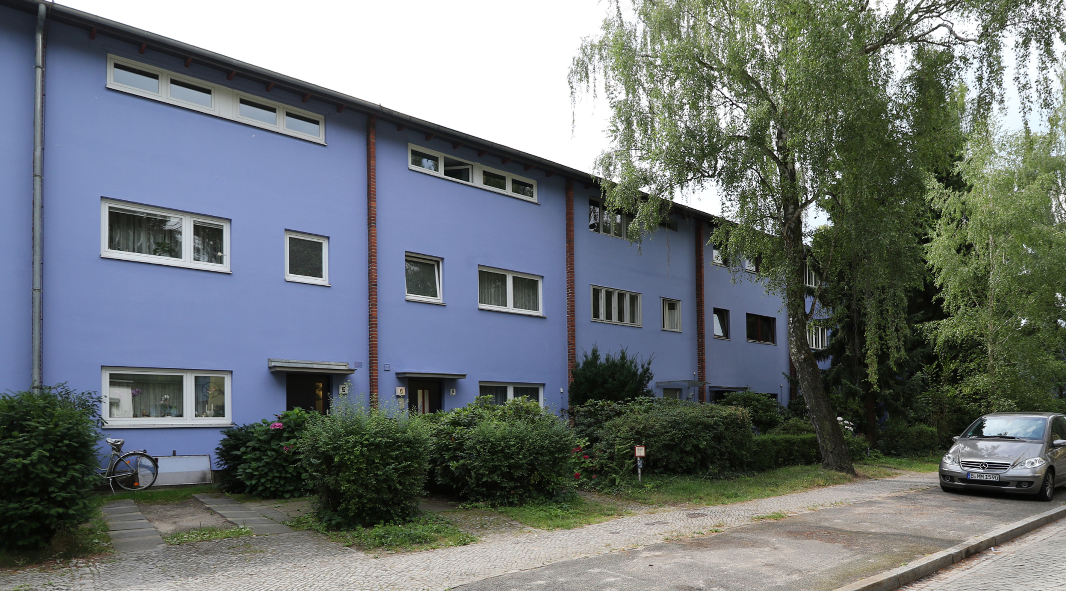
When leaving the Kiefernhof via Im Gestell, the view falls on bold blue terraced houses designed by Otto Rudolf Salvisberg on the opposite side of the street between Waldhüterpfad and Riemeisterstrasse. These row houses are separated from one other by vertical brick bands of firewalls. The houses are painted white on the southern side – garden – side.
Location in the settlement area:: This construction phase is delineated on the north side by Im Gestell, on the south side by Am Fischtal; it includes the southern half of Waldhüterpfad with its cul-de-sac, Reiherbeize, and the southern parts of Riemeisterstrasse as well as Eisvogelweg.
Construction Phase II consisted exclusively of row houses by architects Salvisberg and Häring.
Back to map
06 Individual Shop
Panorama View on the corner of Im Gestell / Riemeisterstrasse
A striking house on the northwest corner of Im Gestell and Riemeisterstrasse appears when looking back to the west – an end building of the west flank of the southern Riemeisterstrasse. Its levels step toward Im Gestell. Its design is reminiscent of the Dutch “De Stijl Movement” in its horizontal form and its elementary red, blue and yellow coloring. This kind of elaborate design can only be found here in the settlement. For a long time, the ground floor was one of the decentralized shops. Today it houses a yoga school. The view to the north along the western side of Riemeisterstrasse shows a completely flush building front with several house entrances. Four different window openings per house lend it some variation. The view of the eastern row of houses opposite – with its living quarters facing the street – shows the three-dimensionally varied house fronts. They consist of recessed loggias and protruding stair towers and feature deep front gardens. Looking to the east into Im Gestell, spaces between buildings come to view which allow a peak into the gardens – to the north as well as to the south. Turning to the south, we see continuous blocks of buildings on both sides of Riemeisterstrasse. The green painted houses on the street side, which are white on the back, have reddish-brown or green wooden roof lines. The architect here is Hugo Häring. These terraced houses, whose buildings extend further south-east, are part of the early Construction Phase II. Back to map
07 Im Gestell
Across from Kiefernhof (Pine Courtyard) exit …
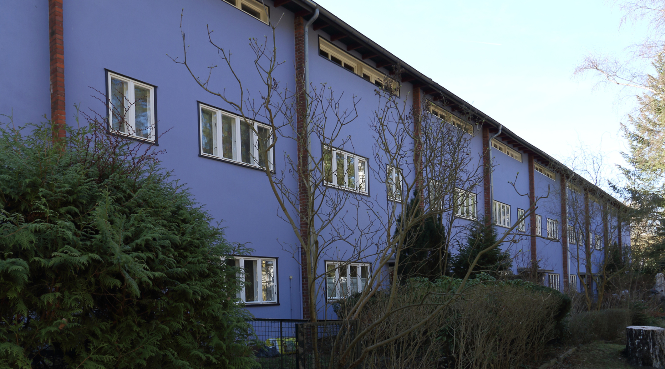
…we head back to the west and the blue block of houses by architect Rudolf Otto Salvisberg. These are also row houses, but they are different from the unified houses of Hugo Häring. Each house here is optically separated by an exposed red brick wall that protrudes by approx. 10 cm. The window openings vary in width and the number of sashes; the frames are painted white. The attic windows were originally designed as a narrow band that served merely to provide light to the attic. The partial conversion of the attic floor into living spaces has led to the emergence of differently-sized windows which detract from the overall uniform appearance.
The entrance doors have been finished with dark blue oil-based paint; the metal grilles for the peep windows are set off in red. This section of the street consists of two parts – one between Riemeisterstrasse and Reiherbeize and the other between Reiherbeize and Waldhüterpfad.
In-depth: While the eastern section’s windows have been significantly altered, the western section’s windows have remained largely in the original state. The beautiful proportions are achieved also through a skillful window division of the facades. Fortunately, the entire street is once again presents itself in a uniform dark blue thanks to the influence exerted on neighbors by an architect who lives there. This row of houses boasts one of the most striking color schemes of the settlement.
Back to map
08 Im Gestell
Street Im Gestell, corner of Reiherbeize
After a few steps into Im Gestell heading west the view opens onto the northern entrance of the street “Reiherbeize”. Since the route does not cover this road, here are some descriptions of its design. The terraced houses by Salvisberg are arranged in the form of two narrow passages in the front and rear. These groups of houses were built using alternate distances to the street, varying the depth of the front gardens. The northern part of Reiherbeize begins immediately with groups close to the street. A bit further south there are also groups of houses that draw close to the street. The street ends with a couple of recessed terraced houses; the houses in between have a front garden depth of approx. 4 meters. This creates, on the one hand, a kind of gate to the south and, on the other hand, a contained inner space between these more restricted alternate areas. This spatial arrangement is enhanced by the color scheme: The houses close to the street are kept in reddish brown, while the setback houses are painted in a whitish tone. The facades of these buildings are separated from one other by protruding reddish brick walls.
The route continues west along Im Gestell and meets the junction of Waldhüterpfad.
Back to map
09 Waldhüterpfad
Im Gestell, corner of Waldhüterpfad
We look first to the north with buildings by Taut– the east and west sides of Waldhüterpfad: On the right, the buildings are flush, flat facades of three story buildings which enclose the Kiefernhof. They are staggered at an angle to the street, forming triangular-shaped front gardens full of trees. On the other side is a long row of houses with its contrasting façade of living spaces. Here again, they are varied three-dimensionally with balconies and stair towers, and slightly curved in keeping with the street.
After crossing with Im Gestell, the Waldhüterpfad row house development continues on both sides of the street in a southly direction. Just like the buildings by Salvisberg on the south side of Im Gestell, these terraced houses are also separated by a protruding brick wall that has been additionally individualized by a nuanced coloring of the house fronts. The color palette, which is only used here, encompasses such hues as olive, umber, and yellow-green.
Route: The Waldhüterpfad housing ensemble by Salvisberg extends to the southern end Im Fischtal. Opposite to the entrance of the cul-de-sac, located in the middle of this block, there is a group of terraced houses that draws close to the street thereby somewhat constricting Waldhüterpfad and dividing it into two sections. Every two years the „Waldhüterpfad Street Festival“ takes place here in the low traffic cul-de-sac.
The houses are 5-meters-wide with extended roof eaves and kitchens facing one another. The proximity of houses create an intimate atmosphere. In the summertime, the plant-adorned gardens extend the living space.
Back to map
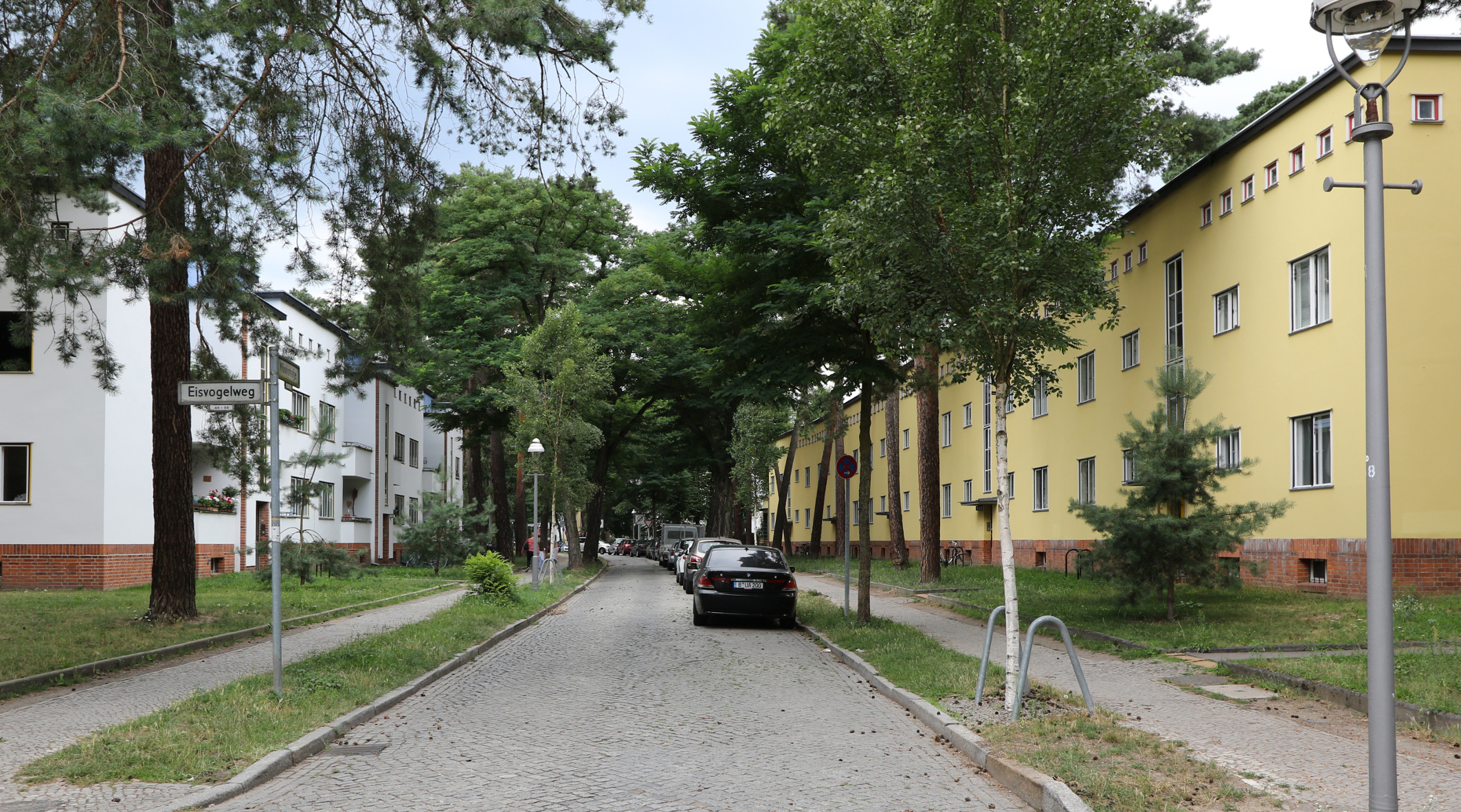
10 Eisvogelweg
Street Im Gestell, corner of Eisvogelweg
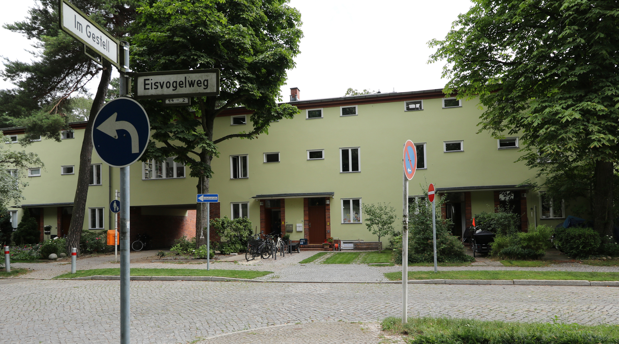
We approach Eisvogelweg from Im Gestell and now turn left to the north.
In contrast to the houses of Otto Rudolf Salvisberg, who divided the houses into rows, Hugo Häring’s houses are grouped into blocks. The color scheme here is uniformly dominated by a light green.
The terraced houses are, as everywhere, two-storied and topped off with an attic. Instead of structural elements separating the houses, two entrances are connected by a masonry plinth and a canopy roof. The windows next to the front doors are repeated on the first floor and in a smaller version on the top floor. The bathroom and WC windows are lined up with the transom window. The wooden roof eaves are red-brown to the street and green to the rear. The path extends Im Gestell, through a ground-floor opening in the housing block, towards the street “Auerhahnbalz”, and passes through the private gardens in back.
Our route takes a left towards Wilskistrasse. Just before the end of the Eisvogelweg ensemble on the right (at number 71) you will find the house of Dr. Julius Leber, who was executed in 1945 in Plötzensee Prison as a member of the Nazi resistance movement.
Back to map
11 Bauabschnitt III
Wilskistraße Ecke Eisvogelweg
The Eisvogelweg ensemble ends approx. 20 meters before Wilskistrasse. The rows of buildings along Wilskistrasse are supplemented by a recessed building at street intersections, resulting in a U-shaped group per block. These set-back buildings create broad spaces that break up the long street. These broad spaces are a special design solution by Bruno Taut, the so-called “outdoor space concept” (Außenhauskonzept); it opens up the residential area. These ensure that the street is not only used for traffic but also serves an open urban space for other activities, somewhat like an urban square.
On the south side, buildings are formed by stairwells and balconies in alternating recesses and accentuated by a white-and-blue-color scheme set off by red brick edges and foundation bases. Historical-accurate renovation in 2013 restored the original appearance and the contrasting color scheme reemerged.
In contrast to the houses on the south side of Wilskistrasse, the houses on the north side are flush with one another and simply painted yellow. Openings between the apartment blocks provide access to the tenant gardens in the rear allotments up to the subway line. There the facades are rather varied three-dimensionally in form, somewhat similar to those of the Kiefernhof – especially its eastern side. Unfortunately, access to the rear of the northern houses is open only to residents.
Back to map
12 Restaurant
Corner of Wilskistrasse and Riemeisterstrasse
Here we are back at the restaurant “Kretaner”, an early building design with its typical round glass corner. Pass by the current dentist office, a single-story building that is not an original part of the settlement, and have a look at the back side of the Peitschenknall (“Whip Snap”). The apartment buildings have three stories with an additional attic floor; the ensemble is visually held together by a continuous blue strip more than 450 meters long. The wide balconies pair off adjacent apartments and the ground floor apartments have direct access to the tenant gardens. Unfortunately the access path along the subway line is not open to the public.
Once we’ve returned to Riemeisterstrasse, the GEHAG gable appears once again on a particularly classical modern building designed by Bruno Taut.
With this we leave the southern half of the settlement built during the first four construction phases between 1926-29 and cross the Argentinische Allee as far as the traffic island.
Back to map
13 Peitschenknall (“Whiplash”)
Argentinische Alleee, corner of Riemeisterstrasse, middle of the traffic island
Construction Phase VI—Peitschenknall—(southern part)
The focus of this construction phase lies in the middle of the settlement between north and south: It extends from the east beginning at northern Waltraudstrasse – or at the southern part of Waldfriedhof Strasse – to Riemeisterstrasse in the west over a length of approx. 550 meters on both sides of Argentinische Allee. This construction phase consists of two parts, the southern part of the linear development and the northern part of a comb-like row development.
The route now reaches one of the most impressive parts of the settlement, Construction Phase VI from 1929-31. The view of Argentinische Allee from the traffic island to the east reveals the slight curve of the main road running in an east-west direction, which follows the curve of the underground line. It determines the main gesture of the settlement and manifests its spacious optics. In fact, it extends beyond Riemeisterstrasse to Onkel-Tom-Strasse and reaches a total length of approx. 750 meters. The nightly street lighting makes this curve stand out even more. The convex curve makes the Argentinische Allee visible in sections, thus preventing an endless effect.
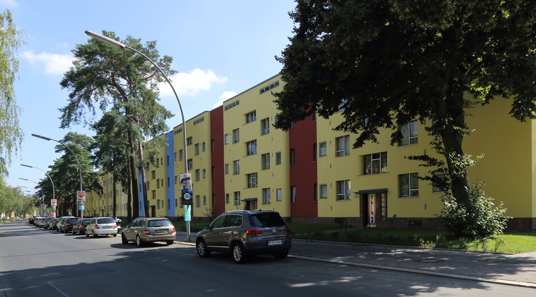
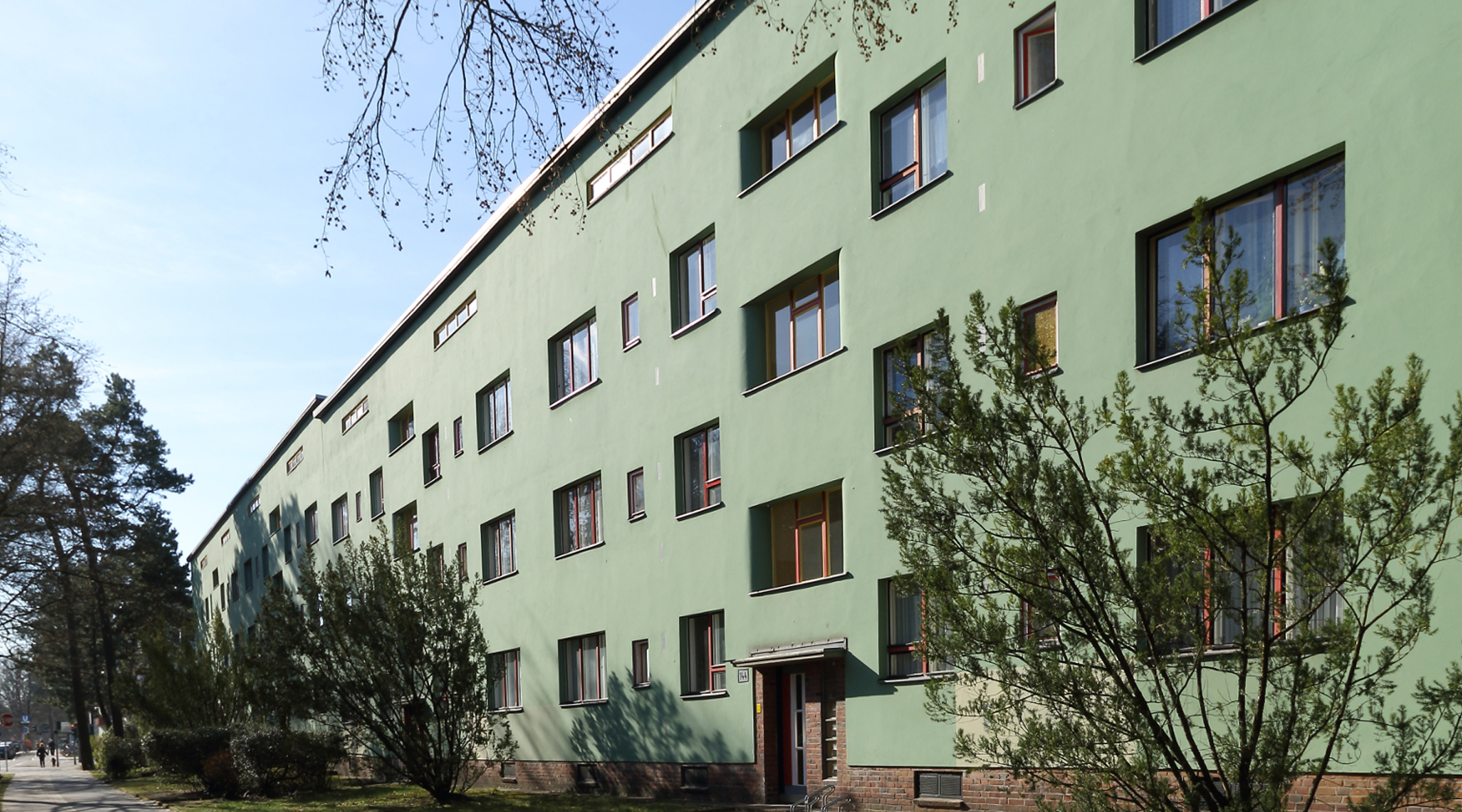
Background Info 1: The linear development extends over a length of about 550 meters. It is made up of 33 individual buildings, each with two apartments per stairway, known as a pair, and six apartments per building. This results in a total number of 198 2½ room apartments for the entire development. The buildings have 3-stories with an additional attic, which is integrated here into the building design. The development as a whole, with its 33 stairways, is structured in its length by approx. 50 cm deep, vertical recesses with rounded edges which demarcate the building units. As in the first three buildings, the entire fronts – seen from Riemeisterstrasse – exhibit a deep yellow coat of paint: The respective building recesses are varied in pairs in the four basic colors – red, blue, white and green (see literature: K. Hüter „Architektur in Berlin 1900 -1933“ with reference to analysis by H. Pitz). The multi-colored front doors and the window frame colors enliven this very long building, which terminates with a set-back building at each end, as it still exists on Riemeisterstrasse. The end building at Waltraudstraße was built in the 70s to replace a war ruin (from one of the few bombings in the settlement). A small shop area was created here with the new building to supplement the subway station’s ‘shopping promenade’.
The rear of the “Peitschenknall”, which can be reached from Riemeisterstrasse via an access path, offers a view of the southern side with large loggias and gardens in front of the white facade. The attic level is accentuated by the blue band extending across the entire length of the building. Colorful flowers in the loggias and tenant gardens, which are directly accessible from the ground floor terraces, emphasize the attractiveness of this “residential landscape”.
Background Info 2: The name “Peitschenknall” (“Whiplash”) – is only part of the complete name, “Whiplash in the face of the bourgeoisie” (PEITSCHENKNALL INS GESICHT DER BOURGEOISIE). Supposedly it refers to the disgruntlement that the architect felt with Zehlendorf politicians. They tried to prevent lower income groups from benefitting from the forest settlement project and made obtaining building permits difficult. The Peitschenknall section was built as a serial large-scale project – a precursor to the industrial organization and production – in response to the so-call “Zehlendorf Roof War” of 1928. This conflict was initiated when 17 architects built mainly detached houses in the “Romantic” style, blocking the views onto Fischtalpark by the residents of the Uncle Tom settlement at Am Fischtal.
Construction Phase VI (northern part)
We now look to the northern edge development of the Argentinische Allee from the street “Am Waldfriedhof” to Riemeisterstrasse and then further to Onkel-Tom-Strasse.
Here 13 row buildings line up perpendicularly to the Argentinische Allee in a comb-like development up to the Riemeisterstrasse; 5 further row buildings up to Onkel-Tom-Strasse. Thus, 18 row buildings altogether. The comb construction between Am Waldfriedhof and the northern part of Riemeisterstrasse consists of row buildings coupled in pairs. The last building component is reduced in height to three floors by omitting the attic.
These row buildings have three-stories, but their green-colored attic floor makes for a four-story appearance. The rows are paired so that their living spaces with continuous band-shaped loggias face one another. They are accessed by a path through the confined green space between them.
Both the Peitschenknall and the comb development up to Riemeisterstrasse were renovated in 2015 in accordance with the historic monumental requirements, including the outside features.
Back to map
14 Papageiensiedlung (Parrot Housing Settlement)
Hochsitzweg, corner Am Wieselbau
This section extends from Hegewinkel near the Grunewald in the north to the southern Hochsitzweg and from the northern part of Riemeisterstrasse in the west to the Holzungsweg in the east.
This quarter north of Argentinische Allee consists mainly of terraced houses with a few detached houses. These were intended for sale from the outset and were also largely sold. By these means a social stratification was introduced early on, since the terraced house buyers came from financially better-off circles. This quarter is relatively separated from the other parts of the settlement and appears to be self-contained. It consists of 5 parallel residential streets running north-south: Am Wieselbau, Am Fuchspass, Treibjagdweg, Hochwildpfad and Am Lappjagen.
Due to time constraints, the tour is routed through Am Wieselbau and Treibjagdweg, touching Am Hegewinkel in the north and Hochsitzweg in the south.
At Am Wieselbau the first house on the southwest corner is custom designed and stands out from the terraced houses. The west side of Am Wieselbau is divided into two sections, whereby the southern terraced house section consists of six 6-meter-wide houses.
According to the general presentation in the following “Background” section, the corner houses are graphically designed on the northeastern ends. On the west side of Wieselbau, at the intersection of Hegewinkel, a boldly-colored gable facade in blue emerges. It is framed by red bricks. This building forms the end of the otherwise linear group of houses at the southwestern end of Hegewinkel.
The color scheme of this part of the settlement is determined as follows: The crossroads are brown-red on the east side and green on the west side. This coloring was inspired by the changing skylight: the brown-red tone of warm evening light, the green tone with cool morning light.
On the northern and southern boundaries of Hegewinkel and Hochsitzweg respectively, most of the houses are painted yellow. The groups of houses at the southern end of the crossroads to Hochsitzweg are interrupted and accentuated by a blue gable. The directly adjoining surfaces of these groups of houses are kept white. The eggplant color of the attic floor elsewhere is omitted here.
Background Info: Houses can be found only on one street side at Hegewinkel in the north and Hochsitzweg in the south. Hegewinkel features terraced houses arranged in groups of different lengths set at an angle to the street.
The Hochsitzweg terraced houses run parallel to the street with interruptions at the junctions of crossroads where houses are set back from the group and present a differentiated design.
The side streets are divided into three groups of houses on the western and eastern sides. This enables a view from the streets into the gardens and vice versa. At these interruptions, the distances of the building fronts from the streets change. When looking east on Hochsitzweg, the end houses on the west side of intersections appear to step forward and thus form a characteristic interplay. In this way Bruno Taut intended to achieve vitality in his town planning. The groups of houses on the east side of the intersections stand – for the most part – flush in a row. Further differentiations result from the fact that the end houses are characterized by wider, three-sash windows.
The head buildings at the southwestern ends of the side streets differ from the rest of the group in that they have multiple set-backs of various building elements, retreating from the street corners. The northeastern street corners are similarly differentiated. This leads the visitor of Hochsitzweg or Hegewinkel into the respective streets. The houses at the opposite ends of the side streets continue flush with the rest of the block.
Back to map
15 Hegewinkel
Am Wieselbau, corner Am Hegewinkel
Terraced houses were constructed on the north side of the street Am Hegewinkel. They are assembled into small groups of two to four houses, which in turn are arranged in staggered blocks of three to four small groups at an angle to the street. Thus six such blocks come together along the street and the houses are painted yellow throughout. This striking arrangement brings the settlement’s design to a close on its northern edge.
The south side of Am Hegewinkel and the north side of Hochsitzweg on the other end of the blocks are formed by the gardens of the north-south streets and offer an unobstructed view – with a few exceptions – of the greenery.
The southwestern end of Am Hegewinkel is formed by a group of nine terraced houses. The eastern head of the row begins with a bold blue gable that echoes the gable color at Hochsitzweg. The rest of the houses are light colored with reddish brown attics, the opposite of the west-facing row houses along the side streets.
If we look into the residential side streets that meet Hochsitzweg, the row houses facing east are painted green, the row houses facing west are reddish brown. According to Taut’s definition or insight, these colors correspond to the character of the sky color – green with the “cold” eastern sky, reddish brown with the “warm” western sky. The dominant color of the two-story main building is complemented by the light white color of the attic. The bright colors of the window frames and sashes, as well as the cover strips and similar variations in the front doors, add to this. The front doors are framed by red bricks and enhanced with red painted metal railings and frames of the entrance roof canopies. In all original front doors, a red transom appears above the door as a connecting element visible from afar. In addition there are front steps and plinths made of red bricks.
A combination of three colors result when looking at the complementary colored facades facing one another and the light-colored attic floors.
The overall impression of the yellow houses on the northern part of Hegewinkel, the multi-color concept of Hochsitzweg to the south and the contrasting colors of the various side streets offer a rich color palette. This housing ensemble is popularly known as “Papageiensiedlung” (“Parrot Settlement”). A congenial characterization that complements other names borne by Taut’s housing estates such as “paint can” (Farbtopf) and “paint set” (Tuschkasten).
Comments: The color of the fronts extends around the house corner; the attic color is partially wrapped around the corner. Together they define the gable ends along Hegewinkel. The same style alternates on the side streets houses where a row is interrupted. An exception to this rule are the northern corners along Hegewinkel: here the green of the east-facing backs of the protruding end houses is picked up, but then change to red-brown when the row houses of the side streets are facing west. The color dividing line is often the corner edge of the house.
Die Reihenhäuser dieses Bereiches wurden sofort nach Fertigstellung zum Verkauf angeboten. Sie wurden auch zumindest teilweise veräußert, zum Schluss zu sehr günstigen Konditionen. Die Preise orientierten sich an den Eigenkapital-anteilen und sonstigen Vergünstigungen der Erwerber.
The terraced houses in this area were offered for sale immediately after completion. In the end they were also sold (and at least in part at very favorable conditions). The prices could be reduced by large down payments and social welfare received by the buyer.
Back to map
16 Hochsitzweg
Hochsitzweg, corner of Treibjagdweg
The Hochsitzweg is – with one exception – only built on one side – on the south. The other side on the left, when coming from the west, is dominated by the corner end houses from the row houses along the five residential streets and the green spaces of their back gardens. The end houses stand out as more or less vividly structured individualized special forms, particularly due to visual line created by the row houses on the south side.
The development of the southern front of Hochsitzweg is divided into 4 segments corresponding to the residential streets. In each case opposite the intersecting streets, the row house continuum is interrupted by the width of a 3 meters on each end of the buildings with a 2 meter wide path in between – i.e. 8 meters total. This path leads to the back plots and is connected to a rear transverse path that connects the other plots to provide access.
The building sections are each formed by similar row houses – 5 meters wide – in the same color scheme. In these sections, the houses to the left and right of the paths are set back 2 meters from the rest of the street front. The terraced houses located along the front building boundary are painted in a yellowish shade on the ground and first floors; the attic floor is set off in a brown-red shade, by a single brick layer and is slightly set back from the lower front of the house. This emphasizes the roof edge.
The aforementioned slightly set-back terraced houses to the side of the access paths are wider (6 meters) and painted white from the ground floor to the top floor. Thus, these houses are set off from the others by their location and coloring, width, window pattern and relief. An interesting effect is achieved by the fact that the side gables facing the access paths are painted in a radiant blue. This has an effect on the side streets and can be perceived from afar.
Background Info: The color design chosen here has to do with the color theory of Bruno Taut, who used color in space with its various depth effects – including protruding and receding effects of different color characters. Here the blue is combined with the contrasting yellow paint in the distant Hegewinkel. Taut’s famous complex color concept is created In interaction with the colors of the other east/west facing residential streets. He transfers the color effects of De Stijl pictures and individual architects of Dutch origin – Mondrian, van Doesburg – to the urban space. This design concept is distinctly emphasized as an essential contribution by Bruno Taut. Accordingly, it is acknowledged in architectural literature. However, it is not only the color that leads to the differentiation of the settlement, but also the variations in the arrangement of the buildings and the design of the buildings themselves.
This makes the length of Hochsitzweg interestingly structured, but also visually connected with the opposite groups of houses. Its slightly convex street layout avoids an endless empty effect.
Back to map
17 Triangle
Riemeisterstrasse, corner of Hochsitzweg
This triangular-shaped settlement area is bordered to the east by the northern Riemeisterstrasse, to the west by the Onkel-Tom-Strasse and to the south by the Argentinische Allee.
This construction phase – this quarter – is thus located in the northwestern part of the entire area.
Route: After leaving the Papageiensiedlung at Hochsitzweg, the route leads to the western side of Riemeisterstrasse and to the last construction phase – the so-called “Triangle”.
Background Info: The building complex “Triangle” (Dreieck) was completed in 1931/32. This was after the Great Depression, which also affected the settlement:
1. larger buildings with more apartments were built
2. the percentage of larger dwellings is high.
The crisis often led to the abandonment of very large and expensive apartments in the city center, and fleeing tenants demanded new, more affordable apartments. GEHAG responded to this need.
Back to map
18 Triangle, North
Passageway between the eastern block of buildings of the “Triangle”
The block development consists of two linear buildings parallel to each of the Riemeisterstrasse on the east side, Onkel-Tom-Strasse on the west side. Inside the “Triangle”, a row of buildings extending from Riemeisterstrasse to Onkel-Tom-Strasse in an east-west direction divides the extensive inner area. Access is only by footpaths since no streets exist within the perimeter. Here, renovation has yet to take place, as is partly the case in Onkel-Tom-Strasse. Back to map
19 Triangle, South
Southern area of the “Triangle”
The block is defined by the two linear buildings along Riemeisterstrasse, Onkel-Tom-Strasse, as above, and three linear buildings between them, arranged perpendicular to Argentinische Allee. The buildings have three-stories plus an attic floor, but each linear block of buildings ends with a 2-storied building, so that the line is stepped down to the courtyard interior.
The colors of these linear buildings alternate in each case. Altogether a sequence from Riemeisterstrasse to Onkel-Tom-Strasse results as follows: Buildings along Riemeisterstrasse are green with a yellow courtyard side and blue balconies; the next building is green with balconies in contrast reddish brown; then comes a reddish brown building with contrasting green balconies; followed by a green building with balconies in contrasting reddish brown. The buildings along Onkel-Tom-Strasse are light brown with a white courtyard side with yellow balconies. The colors of the buildings are contrasted with the colors of the windows and doors in different shades.
In these large green spaces, the considerable expanse allows for transverse views with several colors to be experienced simultaneously, creating multi-tone color spaces.
These two last mentioned quarters (Parrot Housing and Triangle) are highlighted and praised in architectural literature as particularly typical buildings of the color-modernism.
Extras: Here, too, as seen elsewhere in the settlement, ground floor loggias throughout the “Triangle” have entrances to the tenant gardens directly in front of the building. There are no tenant gardens located in the vicinity of the noisy Argentinische Allee.
Background Info: The popular program of creating rental apartments in compact residential complexes came to an end with Construction Phase VII.
An overview of the settlement is as follows:
Some of the housing has been privatized. The six real estate companies that acquired the GEHAG portfolio from the Berlin Senate and the trade union endeavored to sell apartments. The rental apartments have largely been spared so far, but with a few exceptions, the terraced houses, of which GEHAG had held many until the year 2000, have now been sold.
Back to map
20 Commemorative Plaque
Southeast Corner of Argentinische Allee at Riemeisterstrasse
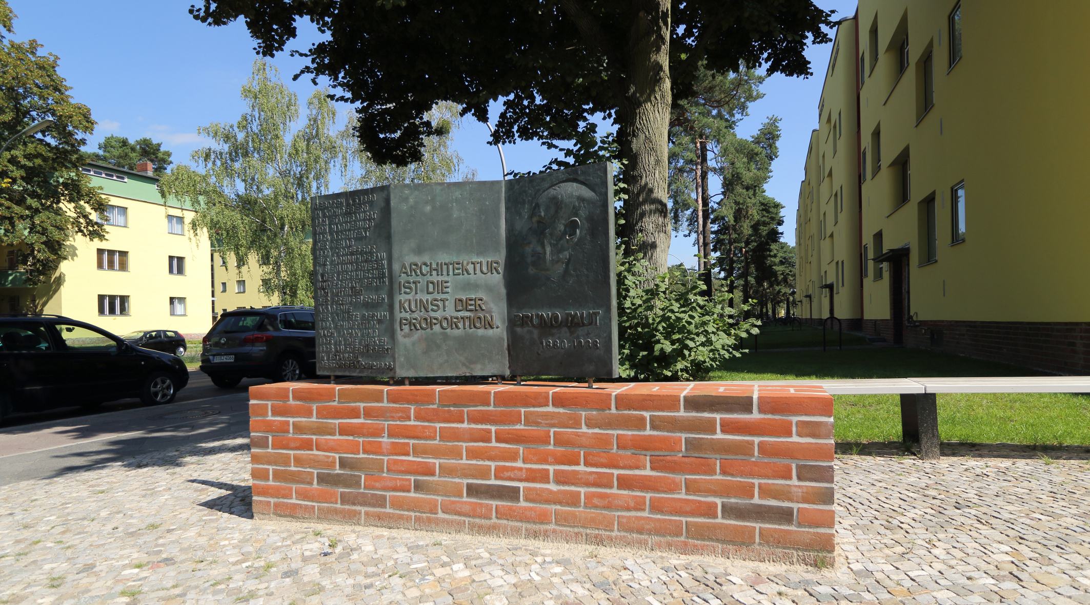
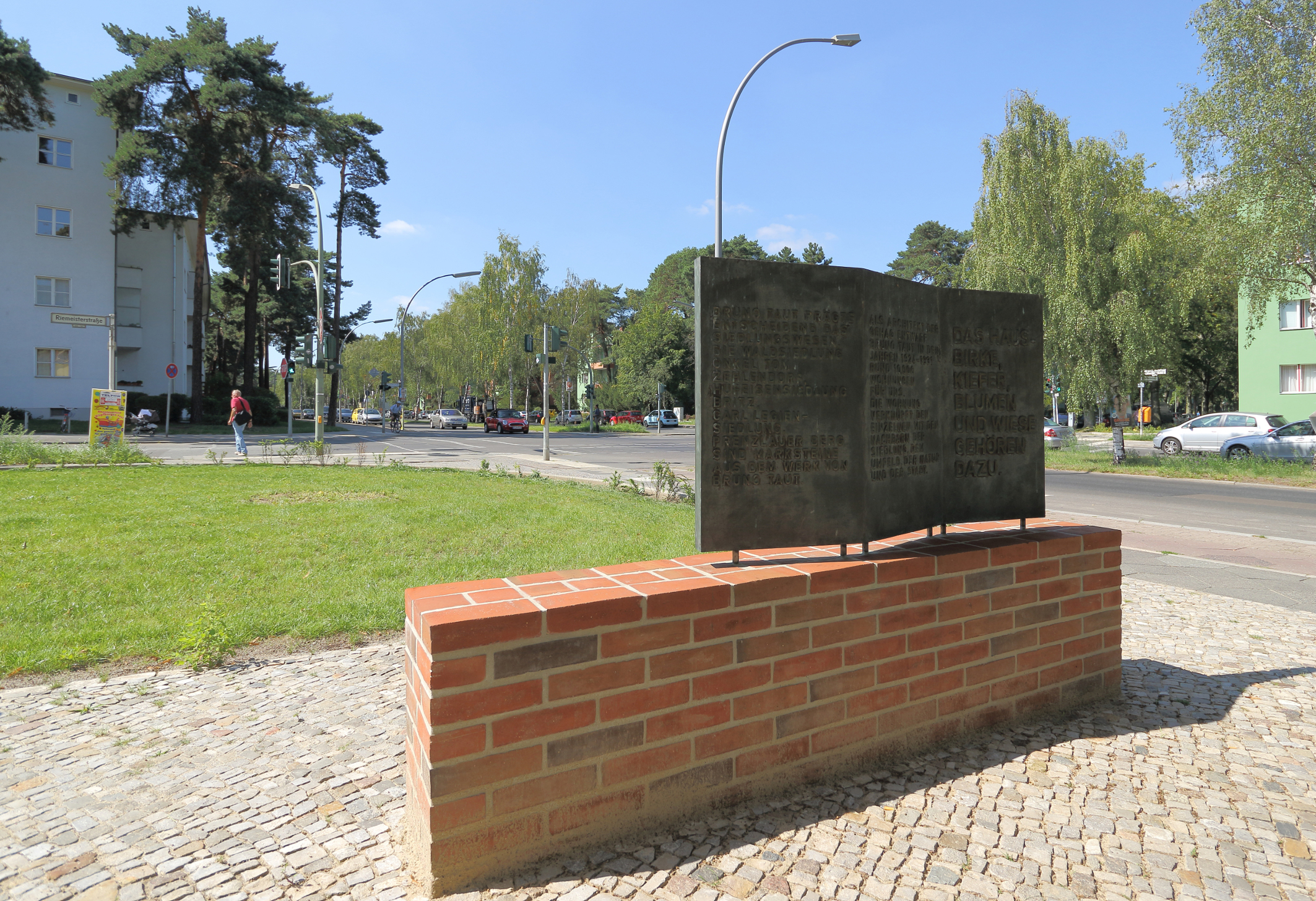
Now we are at the end of the tour. On the corner of Riemeisterstrasse at the Peitschenknall (“Whiplash”) building a commemorative plaque was erected on a brick base for the 50th anniversary of the Bruno Taut’s death on 24 December 1988. The two-sided bronze relief was created by the sculptor Annelies Rudolph – in accordance with a resolution by the Zehlendorf district council. The GEHAG – today “Deutsche Wohnen” – contributed financially to the monument.
24 December 2013 was the 75th anniversary of Bruno Taut’s death.
In 2016 the panel was given a new location and a differently shaped pedestal made of red bricks in connection with the restoration work.
Background Info: After the Nazis seized power, all leading players in the settlement project were forced to leave Germany or risk arrest and imprisonment at a concentration camp: Bruno Taut’s name was at the top of a list. He was forewarned and able to flee in time. Taut found exile first in Japan and then in Atatürk’s Turkey. Ernst Reuter and Martin Wagner, members of the Berlin magistrate, also found exile there. Rudolf Otto Salvisberg was able to find safety in his homeland of Switzerland. Fred Forbat was able to flee to safety in Sweden; Hugo Häring was able to get under the radar in his hometown. Franz Hillinger, an employee of Bruno Taut, was brought to Turkey by Taut. Adolf Sommerfeld, the only Jew involved, was able to flee to safety in England. They were regarded as cultural Bolshevik intellectuals by the Nazis. Many inhabitants of the Uncle Tom Settlement – members and some officials of the trade union and the Social Democratic Party – were dragged into criminal trials after 1933. Some were sentenced to considerable prison terms. Some of their families left the settlement. Their apartments were given to Nazi party members. One of the first measures after the GEHAG was brought into line with the “German Labor Front” (1933) was a ban on renting apartments to Jewish families. Commemorative bronze Stolpersteine (“stumbling blocks”), embedded in pavements in front of houses, mark the homes which Jewish residents were expelled and subsequently sent to concentration camps. Memorial plaques for Dr. J. Leber and Graf von der Schulenburg refer to those murdered in connection with Operation Valkyrie on 20 July 1944.
Back to map